
View-point

The Blocks
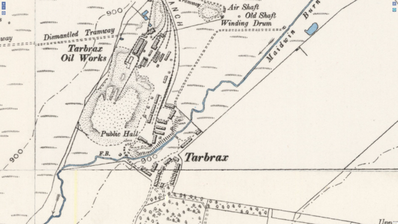
Tarbrax used to be on the other side of the Medway Burn. That's the wiggly line in the middle until I can get some colour into the picture. It was originally the Blocks, (North Terrace), the Model Rows and the 'Auld rows' (The last two may have been the same buildings)
Access from the old site and the industrial area to the new houses was across the bridge in the middle of the picture.
The Model Rows, aka the Auld Rows
Crosswood
Woodside Terrace (Gaffers Row)
Top Rows
Bottom Rows
Gala Picture view-point
The Wee Bing
High Picture
of Tarbrax
view-point
Later
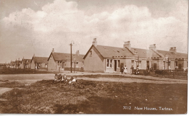
Viewfield
Co-Op
W.A.T. Local History Group for Woolfords, Auchengray, Tarbrax and area.
Tarbrax

I'm sitting behind this window. Now called The Old Manse
It used to be the end two cottages probably 225 & 226. The other 4 rows of the 'Top Rows' to the left (193 to 224) and 227 to 232 are demolished.
Jim H
1913. Now called Viewfield. Numbers 241-288
The Blocks
An image in the same orientation as the photo. The first known houses for the miners were called 'the blocks' now the foundations are buried. I think they were referred to as the North Rows at some point.
The second set of houses were the model rows, later called the Auld Rows.
Crosswood was then built on the other side of the burn (Maidwin)
The 'Top' and 'Bottom' rows built around 1890 are now demolished except for the 2 cottages that in 1931 became the Manse for the Church of Scotland and then The Old Manse.
'Gaffer's Row' (1909) and 'Nob's Row' (19were built at about the same time 1890. More accurate dates are invited.
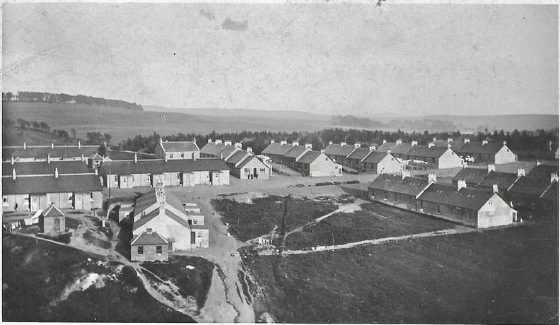
Viewfield was built last at the top of the map (back of the picture) and the remaining occupants of the top and bottom rows were moved there. I've put N and S to indicate approximate compass points
If anyone has more precise dates please tell me.
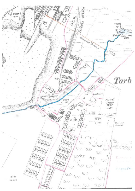
I thought it might be useful to clarify some of the lines on the above map. This shows the Medwin or Maidwin (blue) footpaths and roads (red)
---------------------------
The map below is from 1890 I think. Better guesses invited
S
N